 Activities
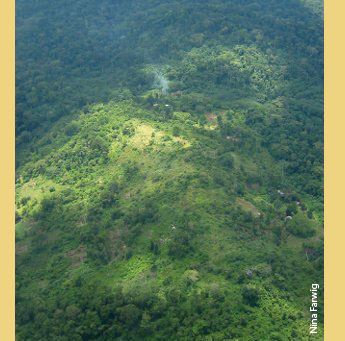

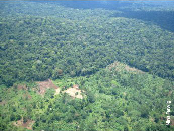
Inhabited enclaves of a long history
within Mabira Forest
Geographical location & uniqueness
|
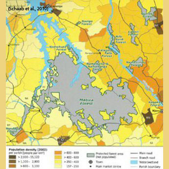
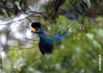
The road connecting Uganda's capital Kampala with Jinja passes Mabira Forest within its southern part. Being located in south-eastern Uganda, people crossing the border from Western Kenya will always get a glimpse of the forest. With the Victoria Nile originating east of Mabira Forest at Jinja, after 20 km the traveller will reach the forest with Kampala being another 54 km distant. The officially gazetted forest area (Mabira CFR) encompasses 29,974 ha and is managed by NFA. The forest reserve is found at an altitude of 1,030 to 1,355 m. a.s.l. Annual rainfall amounts to 1,250 to 1,400 mm. In its northern part the forest is dominated by broad, reed-checked rivers, Sezibwa and Musamya flowing north to Lake Kyoka, while the Nile is passing in 2 km distance to the north-east. Thus Mabira Forest mainly acts as a water catchment area for Lake Kyoga. Its eastern one third of forest cover had been clear-felled many years ago and is now densely covered by exotic paper mulberry trees. The strictly protected nature reserve is found in the core of the natural forest cover. Mabira Forest is the only forest in Eastern Africa that has enclaves which are occupied by human settlements and have their origin in the King of Buganda having settled grasslands inside the forest. These woven-in settlements as well as the adjacent population are creating some tension, with mainly charcoal burning besides timber cutting and agricultural encroachments. As a semi-evergreen forest of the 'Guineo-congolian drier type' the forest inhabits a moderate to high biodiversity compared to other Ugandan forests. Read more about "Forest surrounding" and "Tourist attractions" on the second page. |
|
1 / 2 |