 Activities
GIS day at the BIC:
Giving back to the community
GIS Day is a grassroots educational event that enables GIS users to showcase real-world applications of GIS as a way of building and nurturing their GIS community. It is a global event held on the third Wednesday of November each year where organizations all over the world that use GIS, or are interested in GIS, participate by holding or sponsoring an event of their own.
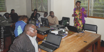
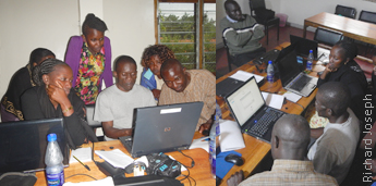
The Biodiversity Information Centre was not left behind in this occasion as it organized a technology transfer session on 19th - 20th November. The participants included field assistants, a researcher from Kenya Wildlife Service and three officers from Nature Kenya. Also, a student from Karlsruhe University of Applied Sciences was present as a facilitator of the session.
This session was organized after repeated requests on data conversion and map composition from researchers and scientists in KFE. The session explored the workflows involved in preprocessing data after collection, and the steps involved in coming up with a map to visualize the information. This would encourage the researchers to apply GIS in their research activities, which would in effect enrich the quality of outputs in their reporting systems and also supplement the datasets at the BIC.
The participants were pleased with what they had learnt in the session and planned to collaborate on such projects in the future. BIC will continue to organize such sessions as one of its objectives is to make use of its facilities and available datasets to assist the researchers and community groups in KFE in their conservation efforts.