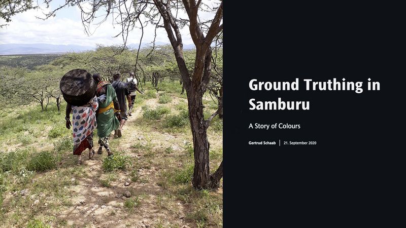
Ground Truthing in Samburu
Gertrud Schaab spent the second part of her research semester, i.e. Dec 2019 to mid-Feb 2020, in Kenya. She was most impressed of experiencing the thorn savannah in green, meaning after the rain. What a contrast to the normally very dry and dusty environment! She gladly took on walking up and climbing hills or rocks in the heat. From there you get a much better impression of the landscape. It helps in the classification of satellite imagery, which Noreen Mutoro is using for her PhD project on topics related to cheetah conservation. Gertrud Schaab compiled impressions of the field trip to Samburu using the tool ArcGIS StoryMaps. In the story map “ Ground Truthing in Samburu – A Story of Colours” she tells her story, supported by many photos and interactive maps.
Teaching Thematic Map Making in South Africa
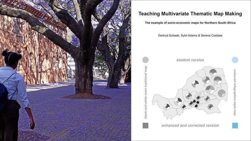
In Aug/Sep 2017 Gertrud Schaab offered a course on Thematic Cartography at the University of Pretoria. South Africa has no particular tradition for thematic maps. A cartographically skillful visualization of multivariate data offers the chance to better understand the prevailing issues of inequality, provision of basic services, and transformation in South Africa. Therefore, Gertrud Schaab used her second stay as Visiting Professor (Sep – mid Nov 2019) for publications on the student maps. Now 28 maps of the four northern provinces are freely available on seven topics: the two student solutions as a black-and-white traditional thematic map, a colored map deploying infographics design elements, and two further versions of the student maps enhanced by Sybil Adams. The revised maps enabled final feedback to the students on their project work after the block course from abroad. Including enhanced maps, the set of maps can be used as a teaching aid to demonstrate how different cartographic presentation methods allow different insights into data and why it makes sense to adhere to cartographic rules and conventions in order to reveal spatial patterns by means of spatial visualization of statistical data (click here).
Developing an Atlas Online Search Tool
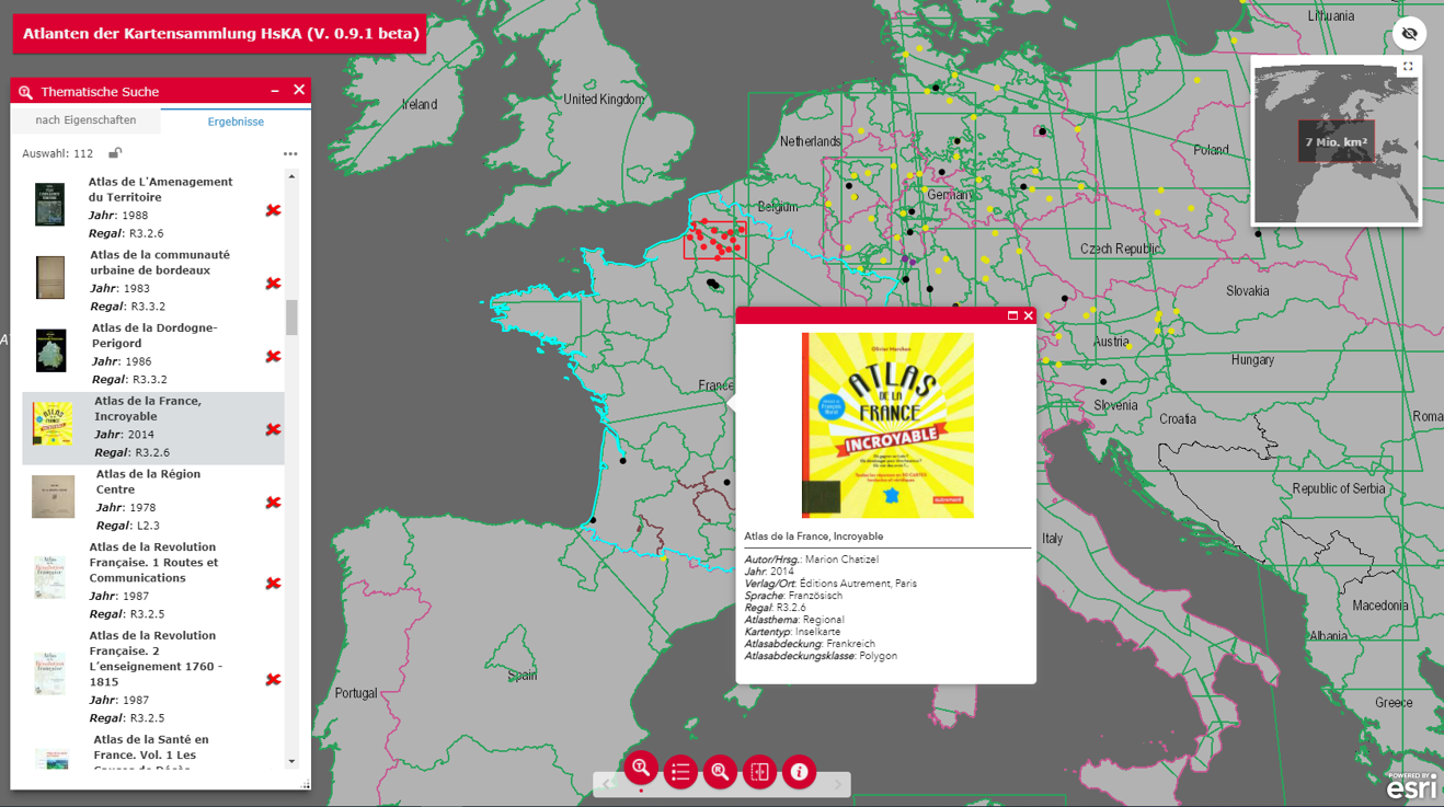
For easier access of the atlas collection at Karlsruhe University of Applied Sciences (HsKA) with its more than 1200 atlas volumes a web application was developed. Map sharing web apps and geoportals are nowadays common for historical topographic map series. The HsKA atlas search web app builds upon their spatial selection concepts but required to modify the popular bounding box representation for the case of atlas visualization. In order to accommodate the versatile atlas coverages, the concept works with ten different geometry types. Built upon the ArcGIS Enterprise platform, development utilized the ArcGIS Web AppBuilder and ArcGIS API for JavaScript for designing the graphical user interface and implementing the desired functionality. The spatial search is evoked by the user maneuvering the web map extent to an area of interest. The dynamic selection process is based upon complex spatial queries accessing the database records directly to improve performance. The interface allows for multiple atlas extents to be viewed at the same time, while facilitating comparison between atlases. The search functionality is further augmented by traditional bibliographic information. In addition, the application includes tools to facilitate maintaining and updating the system when new atlases are added to the collection, as well as to provide visual overviews on the overall holdings.
Karlsruhe, 21/12/2020