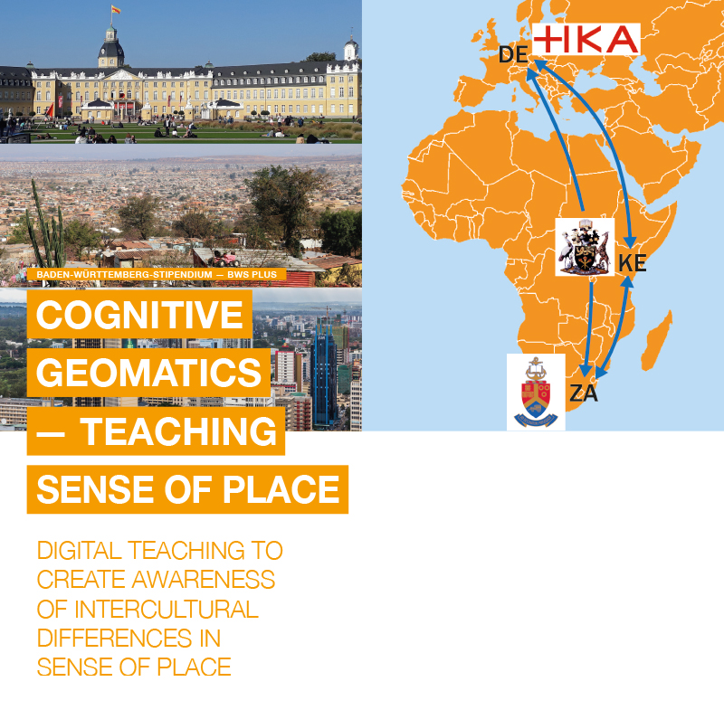
Abstract
The awareness of space ("sense of place") is considered to be a requirement for one’s orientation in action space, but differs from one culture to another. This raises questions about the nature of the interplay between the way we think about and perceive physical space (our mental maps) and the use of geomatics methods for measuring, analyzing and visualizing our environment (in the virtual world). For this purpose, we are developing digital teaching and learning resources together with students, using Germany, South Africa and Kenya as case studies, and we are exploring how to involve students of all three countries in this through virtual means. The project is part of the Baden-Württemberg-STIPENDIUM for university students – BWS plus, a programme of the Baden-Württemberg Stiftung, and runs from March 2022 to February 2025
Project background
The rapid development of information and communication technology together with the processing options in the so-called cloud are leading to a sharp increase in data. Future use and analysis of the location-based aspect of these big data is expected to lead to a boom in geomatics. As a result, these methods will be more and more used by those who are not geomatics specialists. At the same time, it is becoming increasingly clear that the mere positioning of objects based on geographic coordinates does not do justice to the subjective experiences of space and the world around us (space versus place). Spatial perception includes our habits of thought and reflections about the relationship between people and the environment. Whereas awareness of space is considered to be a requirement for one’s orientation in action space. This "sense of place", however, differs from one culture to another and is closely linked to locality and authenticity. This raises questions about the nature of the interplay between the way we think about and perceive physical space (our mental maps) and the use of high-tech methods for measuring, analyzing and visualizing our environment (in the virtual world), which can be described as cognitive geomatics. In teaching and learning, the respective cultural differences are also of interest.
While the BWS plus project "Geomatics & Participation", which started 2015, allowed us to establish a new, sustainable cooperation between the Karlsruhe University of Applied Sciences (Germany) and the University of Pretoria (South Africa), we are now aiming at expanding our network to the University of Nairobi (Kenya) and to also widening the thematic discourse to be of a more interdisciplinary nature.
Baden-Württemberg – South Africa – Kenya
 Baden-Württemberg
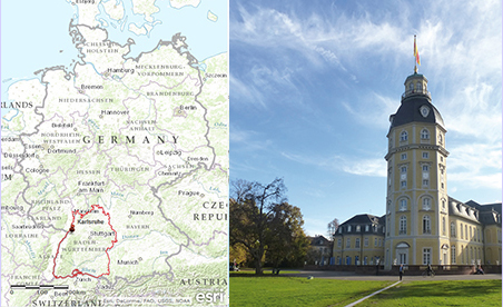
 is the most southwestern state of Germany, bordering France and Switzerland. It promotes itself as a European technology and innovation region. The city of
Karlsruhe is the capital of the Baden region and known as Germany's 'judicial capital' because it hosts all major courts. Founded 300 years ago, it was originally set-up in the shape of a fan with a castle at its centre. The city is placed in the Rhine Valley between the Black Forest to the East and the Palatine Forest and Alsace region to the West.
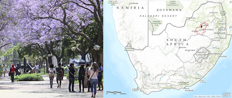 South Africa
 is the most southern country in Africa, bordering Namibia, Botswana, Zimbabwe, Mozambique, Swaziland, and Lesotho. It is commonly referred to as an emerging country on the African continent, i.e. it is leading in regard to economy, society, politics and education in Sub-Saharan Africa.
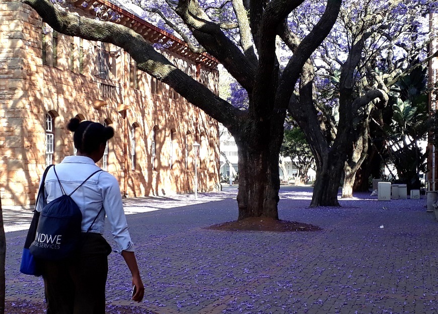
Pretoria is known for the purple Jacaranda trees and serves as administrative capital of South Africa. It is situated in the Gauteng province between the Highveld and Bushveld regions, just 55 km away from Johannesburg, the largest city in South Africa.
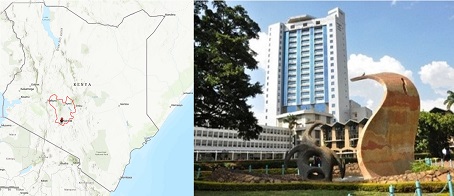 Kenya
Kenya is part of eastern Africa and shares borders with Somalia, Ethiopia, South Sudan, Uganda, and Tanzania. It is referred to as an African developing country with a stable democracy.
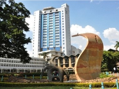
Nairobi is its largest city and the capital of Kenya, known also as the „Silicon Savannah“. It is placed in Central province, 76 km east of the Rift Valley and 143 km south of the equator.
Our aim is to learn with and from each other despite the physical distances between the three countries. Expanding the network by a new partner demands us to take care for a similarly close relationship between each of the three universities.
Karlsruhe University of Applied Sciences – University of Pretoria – Univerity of Nairobi
 Karlsruhe University of Applied Sciences (HsKA)
 is among the largest of its kind in Baden-Württemberg, known for application-oriented education, which leads to readily employable graduates. Approximately 6,700 students, 200 professors, and 660 staff are distributed across six faculties, offering 28 Bachelor and 20 Master study programmes in engineering and economics. For its applied research, the university was able to obtain 12 Mio € of third-party funds in 2021. The
Faculty of Information Management and Media (IMM) has particular strengths in the integrated application of geographic information systems, remote sensing and visualization, e.g. in the environmental field. The faculty is proud of having been labelled as an Esri Development Center.
The
University of Pretoria (UP), together with five other South African universities, is ranked among the top 10 universities in Africa. Approximately, 55,500 students and 1,700 lecturers/ researchers (70% with a PhD) are hosted on seven campuses. They form nine faculties and one business school, which offer 1,175 study programmes (145 at Bachelor-level). UP is a leading research-intensive university in Southern Africa. The project partners are involved in research on spatial infrastructures, addressing, geovisualization, and land use dynamics. At the
Department of Geography, Geoinformatics and Meteorology (GGM), free open-source software is used in teaching.
The
University of Nairobi (UoN)is the only Kenyan university among the 10 top-ranked universities in Africa. 1,500 lecturers/ researchers care for 84,000 students, together with an additional 3,500 staff members. Distributed across 10 campuses, 326 academic programmes are offered by 11 faculties. UoN is a leading research-intensive university in East Africa and Kenya.
Department of Geospatial and Space Technology (GST) dedicates its research to web mapping and remote sensing. In teaching, more of free open-source software is used but not exclusively.
Considering a reduction in travel where appropriate and following the push towards digitization of teaching, we want to test new elements or formats for virtually and sustainably cooperating over a period of three years with changing students.
Project Goals and Approach
We aim at supporting geo(infor)matics towards the desired digitization of teaching by developing building blocks for blended learning. We do so by testing and proving a design for a cooperation focused on an exchange that is feasible under the new conditions of restricted/limited travelling, which delivers results to be of benefit for all project partners in the long term and is usable in different cultures. The approach is based on working together with students on the conceptualization, development and completion of the materials with the involvement of both target groups – lecturers and students. We chose to follow a phased approach, where the three universities take turns with leading, each responsible for a different sub-topic.
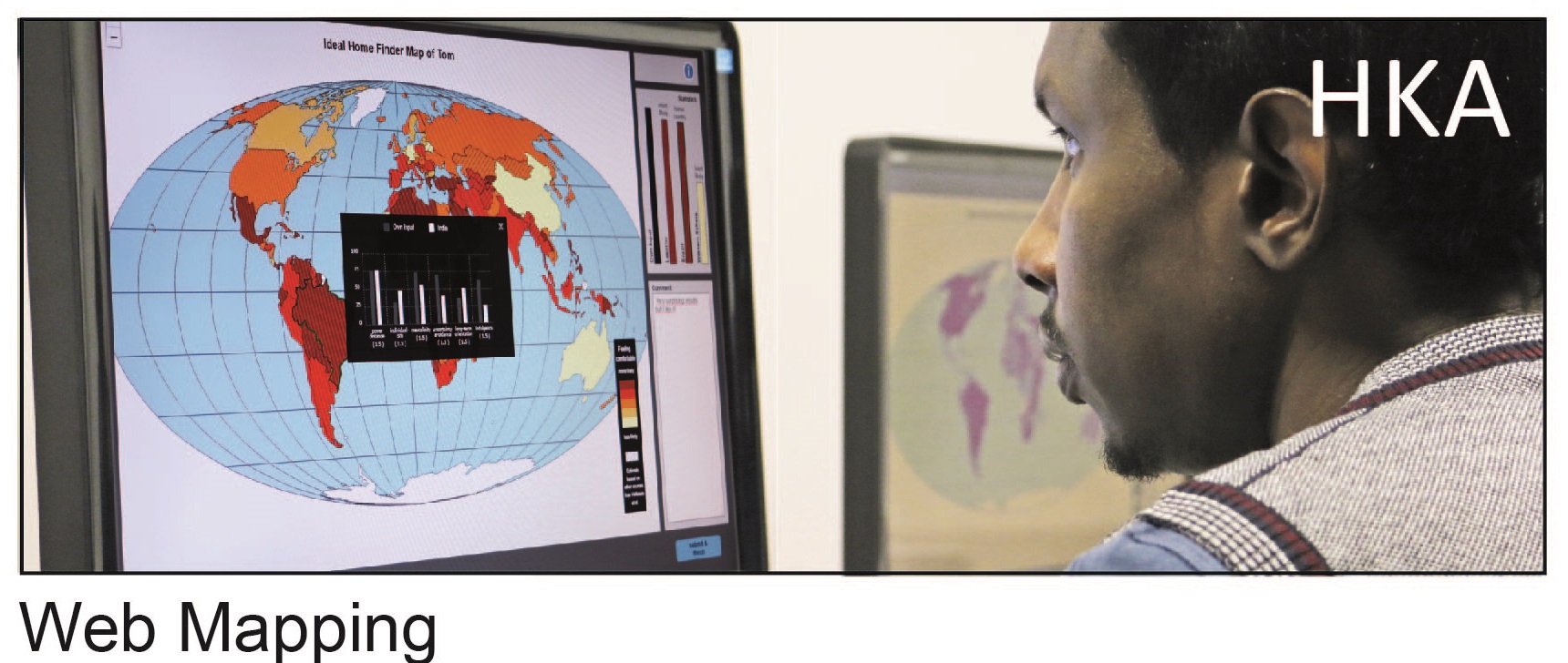
Sense of Place - Web Mapping
In the first phase the focus is on mental maps at different spatial scales versus the visualization of spatial statistical data for different cartographic scales via web mapping technologies. The work started as a semester project at HKA. During an in-person workshop with the active participation of the two partner universities, the learning materials at the time are presented and critically reflected on. For reaching an advanced stage and to ensure that the materials can be used in all three cultural contexts, regular virtual support by the partner universities is provided for feedback.
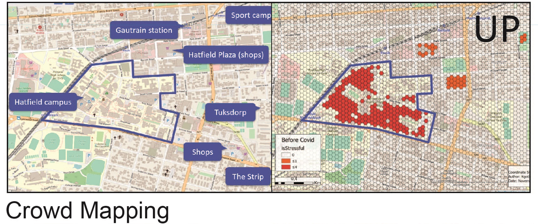
Sense of Place - Crowd Mapping
After that, UP takes the lead following a similar approach (workshop, semester project and active support through participation of all three universities) but with a different thematic focus: The activity space of people will be illuminated, on the one hand through their own imagination but also visualized by using available geodata and thus in a wider spatial context. By developing easy-to-use crowd mapping tools, the participation and involvement of larger groups of people, this at specific locations and online, will become possible.
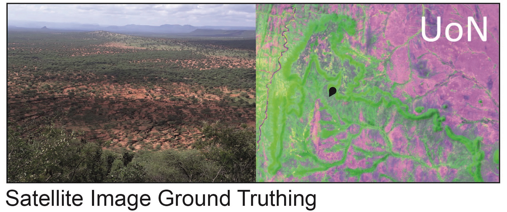
Sense of Place - Satellite Image Ground Truthing
Multispectral satellite sensors scan the environment in different spatial and spectral resolutions. Understanding the interaction (reflection – object dimension – pixel resolution) is required for a meaningful interpretation of satellite images and/or digital image classification. Juxtaposition of ground truth, such as photos, and image composites of different sensors can contribute towards training mental images and thus sense of place. Teaching material for this topic is developed under the guidance of UoN.
We thus consider the special interests and research foci of the project leaders, yet broadly support geo(infor)matics education at the three university locations, all of this under the umbrella of a future-relevant theme. Learning with and from each other in the development of digital teaching materials aims at that the materials are usable at all three universities.
Main Project Activities and Opportunities for Students
For sustaining the cooperation between HKA and UP while expanding the network with UoN, we focus mainly on three measures:
- Workshops and virtual collaboration: to jointly develop digital learning/teaching resources together with students.
- A summer school in Karlsruhe (Germany) with 24 participants from all three universities: to advance the blended learning tool development considering intercultural differences, plus to promote study/research stays at the partner universities.
- Longer study and research trips of 10 under- and postgraduate students from HKA, UP or UoN: to extend and train students’ professional competencies, to allow for intercultural experiences and thus stimulate appreciation for other societies.
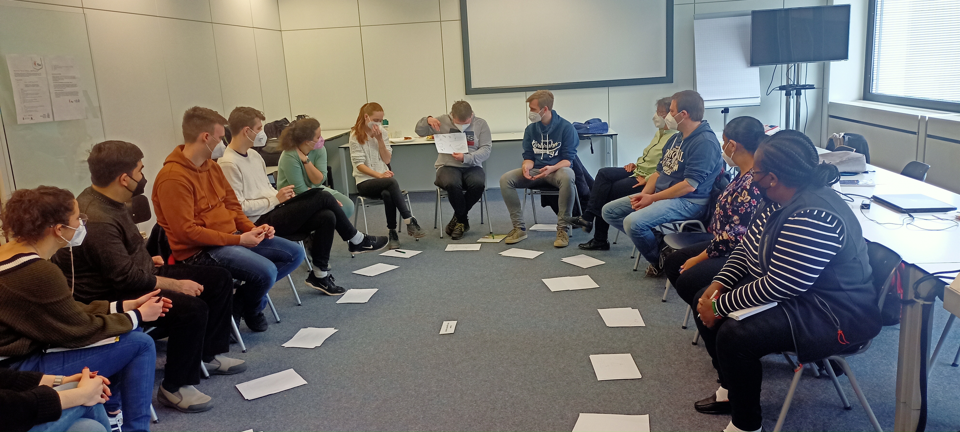
Workshop at HKA
- Topic: Sense of Place – Web Mapping (based on HKA student project work of winter semester 2021/22)
- Aim: presentation of the stage reached in developing blended learning tools and their critical reflection.
- at HKA, 7/8 April 2022 (serving as project kick-off)
- 16 participants: 13 students, 6 lecturers (incl. 3 project partners from Kenya and South Africa)
- Covered: introduction and background, presentations by students, 2 feedback rounds splitting in 3 groups.
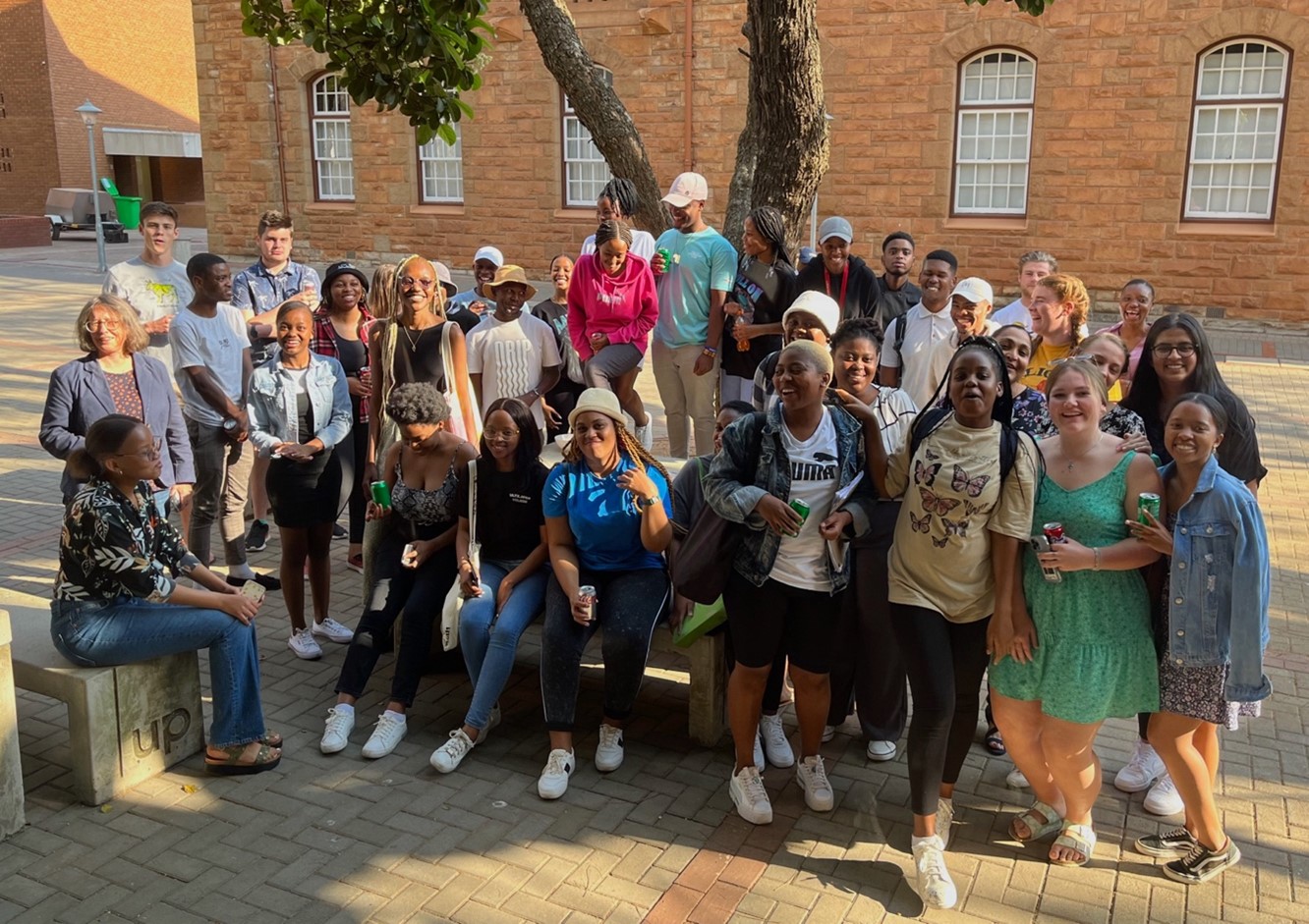
Workshop at UP
- Topic: Sense of Place – Crowd mapping
- Aim: learning from students what to include in a blended learning tool linking crowd mapping and sense of place.
- at UP, 7/8 September 2022 (kicking off phase 2)
- 134 participants overall (incl. 2 project partners from Germany and Kenya, the latter remotely)
- Covered: reflecting usability of crowd mapping tools, student presentations of sense of place assignments, presentation on HKA blended learning tool development.
Project Meeting at UoN
- Aim: facilitating and strengthening the involvement of the new project partner in the cooperation network.
- at UoN, 13-17 February 2023
- Visit by 1 project partner from Germany, virtual participation by 2 project partners from South Africa, involving of 24 students.
- Covered: learning about UoN and Dept. GST, presentations on blended learning tool development so far, informing about summer school and exchange study opportunities.
Summer School in Karlsruhe
- Topic: Sense of Place – Testing and Advancing the Blended Learning Tool Development
- Aim: active testing of the teaching building blocks developed by then for ensuring its use in different cultural contexts
- in Karlsruhe, 17-24 September 2023
- 24 participants, i.e. 6 students and 2 staff members each from HKA, UP and UoN
- Lab work: testing, reflecting and advancing the digital tools and instruction materials developed so far
- Integrated: 3rd workshop, by UoN, on Sense of Place – Satellite Image Ground Truthing
- Socializing programme for personal and intercultural student exchange: incl. visits to Heidelberg and the Black Forest
Individiual Exchange Opportunities
- 10 individual scholarships for an entire semester or a final thesis research period at HKA, UP or UoN (i.e. tailored to the needs of the individual student)
- Timed ideally so that students can actively contribute to the development of the digital materials
- Ensures cultural exchange among students and allows more in-depth work on the overall project topic
- Adjusting (HKA – UP) and establishing (HKA – UoN) procedures relating to the organization of student stays abroad and on-site for the sustainable student exchange
last modified on: 24 Feb 2023